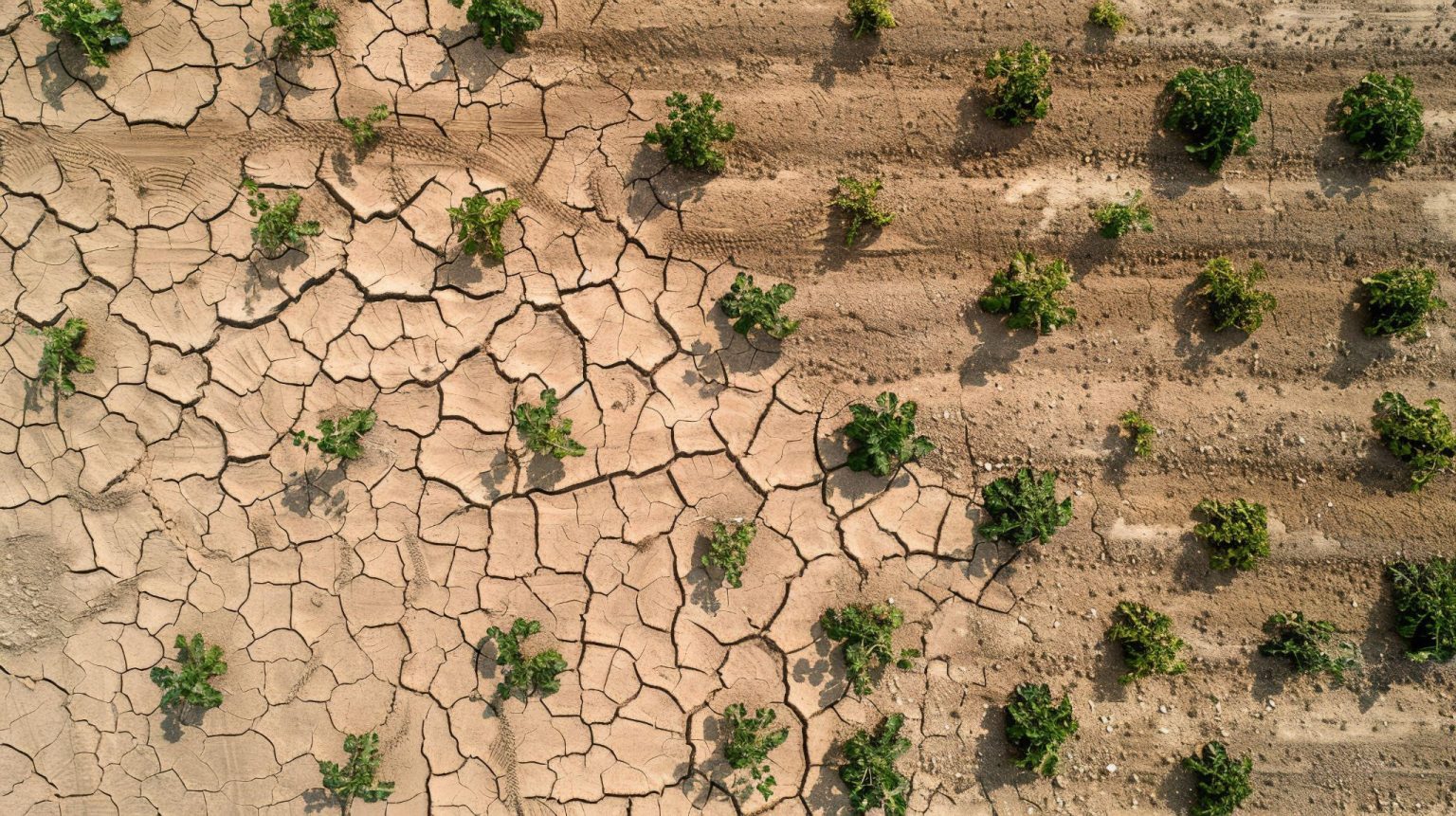
Droughts are among the most devastating natural disasters on Earth. They arrive slowly but have long-lasting consequences for agriculture, water supply, energy production, and ecosystems. Often stretching over months or even years, droughts quietly drain resources and economies, leaving communities vulnerable and in search of sustainable solutions. As climate change intensifies weather extremes, the need for accurate and timely drought monitoring has never been more urgent.
Droughts Monitoring with Satellite Data
In recent decades, satellite data has transformed the way we detect and monitor droughts. Traditional ground-based methods often lack coverage and consistency, especially in remote or politically unstable areas. Satellites offer a comprehensive, global view, delivering consistent and frequent updates that are critical during prolonged dry spells.
From orbit, satellites can observe vegetation stress, soil moisture levels, surface temperatures, and atmospheric conditions, offering an early warning system for impending droughts. Governments, researchers, and humanitarian organizations use the most recent satellite images to understand where droughts are forming and how severe they might become. Today, it is even possible to find latest satellite imagery seamlessly, thanks to platforms that provide up-to-date observations with unprecedented clarity and speed.
These observations support quick response strategies, inform water use policies, and help prioritize aid delivery. For example, the European Space Agency’s Copernicus program and NASA’s Earth Observing System provide reliable datasets used globally to monitor drought development and assess its impact on the environment and human populations.
Indices for Drought Monitoring
Scientists rely on specialized tools known as drought indices to interpret the immense flow of satellite data and monitor dry conditions. These tools provide a standardized way to assess and compare drought severity across different geographic areas.
One of the most commonly used is the Normalized Difference Vegetation Index (NDVI). It assesses plant health by analyzing the contrast between near-infrared light, which healthy vegetation reflects, and red light, which it absorbs. When NDVI values drop, it usually points to vegetation under stress, often due to limited water availability.
The Vegetation Health Index (VHI) builds on this by combining NDVI data with land surface temperature. This allows for better detection of agricultural droughts, especially in areas where crops are affected by both heat and water shortages.
Unlike NDVI, SPI (Standardized Precipitation Index) does not rely on vegetation but instead uses rainfall data. It measures the deviation of precipitation over various time scales from historical averages, identifying both short-term and long-term droughts.
Soil Moisture Index (SMI) focuses on the moisture content in the upper soil layer, which is essential for crop growth. Data from satellites like SMAP (Soil Moisture Active Passive) help estimate this parameter with high accuracy.
These indices, especially when used together, provide a multi-dimensional view of drought evolution and impact. By combining data over time, experts can detect emerging trends, verify forecasts, and understand long-term climate patterns.
Other Technologies Used for Drought Monitoring
While satellite data is central to drought monitoring, it is not the only tool available. Ground sensors, weather stations, and hydrological models continue to play important roles. These systems offer detailed local measurements that satellites may miss.
Artificial intelligence is increasingly used alongside the latest satellite images to improve accuracy and forecasting. Machine learning models analyze historical and real-time satellite datasets to predict how a drought might evolve in the coming weeks. Additionally, remote sensing data can be integrated with crop models and socioeconomic data to assess the full impact of a drought on food security and livelihoods.
Drones and unmanned aerial vehicles (UAVs) are also used for localized monitoring, especially in areas where detailed, high-resolution imagery is needed. These tools complement satellite data and enhance the understanding of on-the-ground conditions.
Satellite Data in Climate Change
The value of satellite imagery extends beyond droughts. Satellites have become indispensable in monitoring broader climate change indicators, such as ice sheet melting, sea level rise, forest degradation, and global temperature shifts.
By continuously providing up-to-date satellite images, researchers can detect and analyze long-term changes in the Earth’s systems. For instance, satellites monitor changes in snow cover, track desertification, and assess freshwater availability, all of which are linked to climate dynamics. Observations over time also help verify climate models and inform international climate agreements.
Moreover, satellites play a key role in tracking greenhouse gas emissions and carbon sinks. Instruments like NASA’s OCO-2 (Orbiting Carbon Observatory-2) are designed to measure atmospheric CO₂ concentrations, offering insights into both natural and human-driven changes.
A practical example is the work done by NASA’s GRACE mission, which measures changes in Earth’s gravity field to monitor underground water reserves. This helps detect “invisible” droughts in aquifers and supports better water resource management.
As our planet faces more frequent and intense droughts due to climate change, satellite technology offers hope. It allows us to act early, respond intelligently, and adapt our behavior in a world where water security is increasingly fragile. From crop fields in Africa to reservoirs in the American West, satellites are watching, recording, and helping us make smarter decisions with each new pass over Earth. And with tools to access the latest satellite imagery maps, we are no longer in the dark but are rather looking from above, learning from space, and preparing for a drier, more complex future.
Author:
Kateryna Sergieieva has a Ph.D. in information technologies and 15 years of experience in remote sensing. She is a scientist responsible for developing technologies for satellite monitoring and surface feature change detection. Kateryna is an author of over 60 scientific publications.


